|
Additional Lessons |
 About These
Lessons About These
Lessons
The following classroom lessons are great for students
who want additional listening and reading practice. |
-
Travel America -
Beginner
Level. Do you love America and American
English? Learn before you travel. Facts and other
cool stuff about your favorite U.S. state. Great
English reading practice.
|
 Travel
America - Alaska Travel
America - Alaska
(Beginner -
Reading)
Learn some interesting facts and read interesting
stories about Alaska. |
 Alaska Alaska
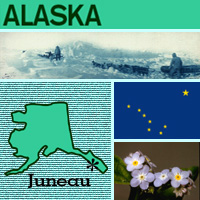
The nickname of the 49th state, Alaska, is the "Last
Frontier." Purchased from Russia for $7 million in
1867, Alaska is the largest state in area and is the
largest peninsula in the Western Hemisphere. Mt.
McKinley in the Alaska Range is North America's
highest peak at 20,320 feet and one of the greatest
challenges for mountain climbers. Juneau is the
state's capital, and the state flower is the
pale-blue forget-me-not. |
Alaska
State Flag
Alaska's state flag features The Big Dipper ("Ursa
Major" or "Great Bear" constellation) as a symbol of
strength, and Polaris (the North Star ) as a symbol of
Alaska's northern location and "the ever constant star for
the mariner, the explorer, hunter, trapper, prospector,
woodsman, and the surveyor..." (quote from legislation). The
blue background represents the sky, sea, lakes, and
wildflowers of Alaska (the official state flower is also
blue).
History of Alaska's Flag
The Alaska state flag (selected for its simplicity,
originality, and symbolism) was created by Benny Benson, a
13-year-old 7th grader from an orphanage in Seward, Alaska
(John Bell Bensona; 1913-1972). Seward honors him with a
monument on 3rd Avenue. Alaska's state song is titled
"Alaska's Flag."
Notes: The North star is also
found on the state flag of Maine. The Big Dipper
constellation also contains "The Delaware Diamond" (state
star of Delaware). |
|
Source:
State Symbols USA |
|
|
 Alaska
State Facts Alaska
State Facts
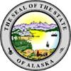
Picture: state seal of Alaska |
|
State Capital |
Juneau |
|
Nickname |
Last Frontier, Great Land, Land of the Midnight Sun |
|
Motto |
North To The Future |
|
Statehood |
January 3, 1959 (49th) |
|
Origin of Name |
Russian version of Aleutian word "Alakshak" meaning
"great lands" or "peninsula." |
|
Largest Cities |
Anchorage, Fairbanks, Juneau, Sitka, Soldotna |
|
Border States |
None |
|
Area |
570,374 sq. mi., Largest state |
|
State Bird |
Willow Ptarmigan |
|
State Flower |
Forget Me Not (myosotis alpestris) |
|
State Tree |
Sitka spruce (picea sitchensis) |
|
State Song |
Alaska's Flag |
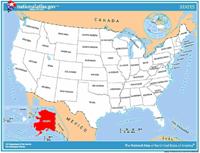 Travel and tourism site for Alaska - This state travel and
territorial tourism site provides ideas for your vacations,
meetings, and more. Travel and tourism site for Alaska - This state travel and
territorial tourism site provides ideas for your vacations,
meetings, and more. |
|
|
Alaska Stories |
|
|
The Alcan Highway in Alaska Opened First full
day of traffic in November of 1942
Have you traveled on any memorable highways in the U.S.? You would
surely remember the Alcan Highway. Following chilly festivities held
the day before with a temperature of 35 degrees below zero, the
Alaska-Canadian (Alcan) Highway opened for its first full day of
traffic on November 21, 1942. This important overland military
supply route, a 1,522-mile roadway through the wilderness, connected
Dawson Creek, British Columbia, with Fairbanks, Alaska. The threat
of Japanese invasion through Alaska made the road a World War II
priority. Over the Alcan Highway, the military could transport
troops, food, and supplies to strategic points in Alaska. How long
do you think it took to construct?
When the Japanese invaded the nearby Aleutian Islands, completing
the highway became even more urgent. More than 10,000 U.S. troops
worked in cooperation with Canadian troops and independent
contractors to accomplish this remarkable engineering feat in just
over eight months! Among those soldiers building the Alcan Highway
were four units of the Army's Black Corps of Engineers. All troops
worked under extreme conditions. Mosquitoes and flies swarmed them
in the summer heat, and temperatures near 40 degrees below zero
chilled them to the bone in winter for weeks on end. To build the
Sikanni Chief River Bridge, men waded chest deep into freezing
waters to place the trestles. To keep themselves going, some of the
men sang. Some African American soldiers, mainly from the South,
sang old work chants like this "Steel-Driving Song."
In addition to military personnel, about 2,000 civilians worked to
construct the Alcan Highway. One advertisement stated, "THIS IS NO
PICNIC! Working and living conditions on this job are as difficult
as those encountered on any construction job ever done in the United
States or foreign territory. . . ." But workers signed on anyway.
Known by the men who built it as "The Road," the Alcan Highway is
still Alaska's main link to the "lower 48" states. It is considered
quite a challenge to drive, but a magnificent journey. If you
traveled it, you might agree with an 1888 travel guide to Alaska,
which stated, "Our trip to Wonderland will remain to the end of our
lives a bright chapter in our experience." |
|
|
Marilyn Jordan George, Following the Alaskan
Dream
Have you ever been on a boat? Can you imagine living on one? In 1946
Marilyn Frink Jordan George left her home in the Iowa farm country
to marry a U.S. Navy veteran who became a fisherman in southeast
Alaska. She and her husband lived on a fishing boat and raised four
children. Marilyn Jordan George was a writer, and her decision to
move to the Alaskan wilderness provided a lot of material for her to
write about.
She wrote a book about their lives called Following the Alaskan
Dream: My Salmon Trolling Adventures in the Last Frontier. She
described the drastic change in her life -- going from a corn-fed
Midwestern upbringing to the rough challenges of frontier living on
a boat. Imagine how different the wide-open spaces of Iowa are from
the confining space of a boat. During their early years, the four
George children always wore life preservers. While Mrs. George
looked after the children, her husband trolled (a kind of fishing)
the coast of Alaska for salmon.
In addition to writing the book about her family life, Mrs. George
had a successful journalism career writing articles for many Alaska
magazines. |
|
|
The Alaska Native Heritage Center
How many ways can you think of to say "Welcome"? In Alaska there are
at least 11different ways! That's because there are 11 distinct
cultural groups of Native Indians who live in Alaska and have their
own languages, customs, and hunting and fishing practices.
The Athabascans say "Chin'an gu nin yu," which literally means,
"Thank you, you came here." They come from the interior of Alaska,
from Fairbanks to south central Alaska near Anchorage. The Yup'ik
and Cup'ik come from southwest Alaska, and they, as well as the
Athabascans, were a nomadic people. They traveled from place to
place rather than settling in one area. When the Yup'ic welcome you
they might say "Waqaa" or "Quyakamsi."
The Eyak, Tlingit, Haida and Tsimshian live in south central Alaska
and the southeast Panhandle of the state. They depend upon the ocean
and rivers for their food and means of travel. Although they have
similar cultures, their languages are different. If you go to Saxman
Village in Ketchikan, you might be greeted with "Yak' ei haat
yigoodee," which means, "It is good that you have come." Think of
how many ways you know to say "Welcome." Do they have slightly
different meanings? |
|
|
Anchorage Fur Rendezvous
What do you think the woman in the photo is doing?
She is competing in the Inuit Blanket Toss. As you can see from the
picture, it's sort of like jumping on a trampoline, except the
people who are holding the blanket are raising and lowering it to
toss the woman. This is a game often played at festivals and other
Inuit celebrations. The "blanket" for the game is usually made from
seal or walrus skins, so it can handle the pounding that results
every time a player lands on it after a "toss." The winner is the
player who bounces the highest.
This game started when mountain men, Inuits and fur traders used to
meet in a pre-arranged place in the early spring each year to trade
their winter's kills (furs) for cash and supplies. In the early
1900s, these meetings stopped happening because modern trappers and
fur buyers had no use for them. But in the 1930s, a group of people
who wanted to preserve their history brought back these meetings in
the form of a 10-day celebration where games like the Blanket Toss
are played. |
|
|
Alaska's High Point
Do you know the name of the highest mountain in the United States?
What about in North America?
The answer is the same: Mount McKinley. At 20,320 feet Mount
McKinley is the highest mountain peak in the United States as well
as North America. It is part of the 600-mile-long Alaska Range of
mountains. Named for U.S. President William McKinley, the mountain
is called "Denali," meaning "The High One," in the native Athabascan
language.
Mount McKinley National Park was created in 1917 as a wildlife
refuge. By 1980, it had been enlarged and renamed Denali National
Park and Preserve. The park is enormous. At more than 6 million
acres, it is larger than the state of Massachusetts. The park
continues to be a refuge for wildlife such as caribou, moose, and
grizzly bear. |
|
|
Iditarod Trail Sled Dog Race
Have you ever been in a race? How long was it?
How would you like to be in a race that is more than 1,000 miles
long, involves treacherous climbs, and lasts for nine to 20 days in
sub-zero temperatures, much of it in darkness and blinding winds?
Sounds incredible? Well, that is what some people do every year in
the Iditarod Trail Sled Dog Race in Alaska.
Called "the last great race on Earth," the Iditarod (pronounced
eye-DIT-a-rod) consists of teams of 12 to 16 dogs pulling a sled
driven by a man or woman, called a "musher." The race, which begins
on the first Saturday every March, runs from Anchorage in the south
to Nome on the western Bering Sea. The journey takes the mushers
over mountains, through dense forests, and across frozen rivers and
tundra. Each year 50 to 80 mushers leave the starting gate, and for
many of them their main goal is just to complete the race. The
Iditarod is the ultimate test of humans and animals against nature. |
|
|
Lore of Fishing and Marine Harvesting in
Kachemak Bay
Wow, that's a pretty big fish! In fact, a halibut can grow to more
than 700 pounds! How do you think fisherman catch a fish like that?
In Kachemak Bay, there are many different methods of fishing.
Kachemak Bay, Alaska, is one of the richest fishing grounds in the
world. People have lived there for thousands of years. Even though
it's in Alaska, its climate is fairly mild. The many land and sea
animals provide a source of food as well as income for the locals.
After the coal industry died out in the 1900s, the locals turned to
fish to make a living, and Homer became the commercial and
transportation hub of the area.
Because there are so many different kinds of fish and marine life,
there are many different vessels and nets to catch them with. "Pots"
are used to catch crabs, nets are used to catch salmon, and
"trawlers" (boats with nets that drag the bottom of the sea) are
used to catch shrimp. Vessels used in fishing include "seiners,"
(such as canoes from which nets are pulled in by hand and
transferred to larger boats with powerful net-handling equipment),
and "gill-netters," which range in size and often have sails to keep
them moving with the wind. |
|
Source:
Library of Congress |
|
 National
Forests, Parks, and Monuments of Alaska National
Forests, Parks, and Monuments of Alaska
The following is a description of national
forests, parks, and monuments in the state
of Alaska. If you plan to visit or live in
Alaska for awhile then you should definitely
plan to visit some of these fantastic
places. |
|
|
|
National Forests |
 Chugach Chugach
As the third largest National Forest,
Chugach covers three unique landscapes: the
Copper River Delta, Eastern Kenai Peninsula,
and Prince William Sound. Many of the
streams contain salmon and trout, and
glaciers still carve the land here. Over
half of the forest is tundra and glaciers. |
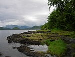 Tongass Tongass
The largest National Forest, Tongass spans
500 mi (800 km) in southeast Alaska from the
Canada–US border to the Pacific Ocean.
Nearly one-third of the forest is covered by
19 wilderness areas. The forest includes
Misty Fiords and Admiralty Island National
Monuments. |
|
|
|
National Parks |
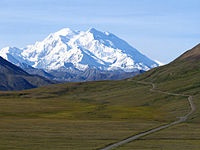 Denali Denali
Centered on Denali, the tallest mountain in
North America, Denali is serviced by a
single road leading to Wonder Lake. Denali
and other peaks of the Alaska Range are
covered with long glaciers and boreal
forest. Wildlife includes grizzly bears,
Dall sheep, caribou, and gray wolves. |
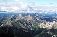 Gates
of the Arctic Gates
of the Arctic
The country's northernmost park protects an
expanse of pure wilderness in Alaska's
Brooks Range and has no park facilities. The
land is home to Alaska Natives who have
relied on the land and caribou for 11,000
years. |
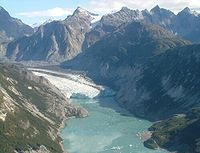 Glacier
Bay Glacier
Bay
Glacier Bay contains tidewater glaciers,
mountains, fjords, and a temperate
rainforest, and is home to large populations
of grizzly bears, mountain goats, whales,
seals, and eagles. When discovered in 1794
by George Vancouver, the entire bay was
covered by ice, but the glaciers have since
receded more than 65 miles (105 km). |
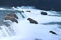 Katmai Katmai
This park on the Alaska Peninsula protects
the Valley of Ten Thousand Smokes, an ash
flow formed by the 1912 eruption of
Novarupta, as well as Mount Katmai. Over
2,000 grizzly bears come here each year to
catch spawning salmon. Other wildlife
includes caribou, wolves, moose, and
wolverines. |
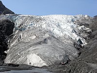 Kenai
Fjords Kenai
Fjords
Near Seward on the Kenai Peninsula, this
park protects the Harding Icefield and at
least 38 glaciers and fjords stemming from
it. The only area accessible to the public
by road is Exit Glacier; the rest must be
viewed or reached from boat tours. |
 Kobuk
Valley Kobuk
Valley
Kobuk Valley protects 61 miles (98 km) of
the Kobuk River and three regions of sand
dunes. Created by glaciers, the Great Kobuk,
Little Kobuk, and Hunt River Sand Dunes can
reach 100 feet (30 m) high and 100 °F (38
°C), and they are the largest dunes in the
Arctic. Twice a year, half a million caribou
migrate through the dunes and across river
bluffs that expose well-preserved ice age
fossils. |
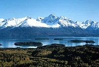 Lake
Clark Lake
Clark
The region around Lake Clark features four
active volcanoes, including Mount Redoubt,
as well as an abundance of rivers, glaciers,
and waterfalls. Temperate rainforests, a
tundra plateau, and three mountain ranges
complete the landscape. |
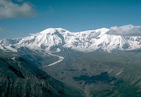 Wrangell–St.
Elias Wrangell–St.
Elias
An over 8 million acres (32,375 km2) plot of
mountainous country—the largest national
park in the system—protects the convergence
of the Alaska, Chugach, and Wrangell-Saint
Elias Ranges, which include many of the
continent's tallest mountains and volcanoes,
including the 18,008-foot Mount Saint Elias.
More than a quarter of the park is covered
with glaciers, including the tidewater
Hubbard Glacier, piedmont Malaspina Glacier,
and valley Nabesna Glacier. |
|
|
|
National Monuments |
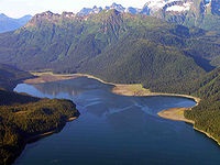 Admiralty
Island Admiralty
Island
Occupying most of Admiralty Island, the 7th
largest in the United States, this monument
is part of Tongass National Forest in
Southeast Alaska. The monument protects the
densest known population of brown bear on
Earth, along with habitat for the Sitka
black-tailed deer. Most of the monument has
been designated as the Kootznoowoo
Wilderness, restricting future development.
The Greens Creek mine lies within the
monument. |
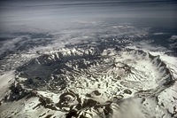 Aniakchak Aniakchak
Mount Aniakchak, which erupted 3,500 years
ago, and the surrounding region make up one
of the least visited NPS sites. Surprise
Lake, within the volcano's 6-mile (9.7 km)
wide, 2,500-foot (760 m) deep caldera, is
the source of the Aniakchak River. |
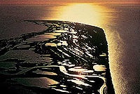 Cape
Krusenstern Cape
Krusenstern
Co-located with the NHLD Cape Krusenstern
Archeological District, this coastal plain
contains large lagoons and rolling hills of
limestone. The bluffs record thousands of
years of change in the shorelines of the
Chukchi Sea, as well as evidence of some
9,000 years of human habitation. |
 Misty
Fjords Misty
Fjords
Located within the Tongass National Forest
and called The Yosemite of the North for its
similar geology, it also contains the Quartz
Hill molybdenum deposit, possibly the
largest such mineral deposit in the world.
Throughout the monument is light-colored
granite, about 50 to 70 million years old
(Eocene Epoch to Cretaceous Period), that
has been sculpted by glaciers that gouged
deep U-shaped troughs. Mountain goats live
in the higher elevations, while brown and
black bear are also common. |
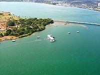 World
War II Valor in the Pacific World
War II Valor in the Pacific
Valor in the Pacific encompasses nine sites
in three states associated with World War
II: The Attack on Pearl Harbor, including
the USS Arizona, Utah, and Oklahoma
memorials in Hawaii; the Aleutian Islands
Campaign on Attu Island, Kiska Island, and
Atka Island in Alaska; and the Japanese
American internment at Tule Lake War
Relocation Center in California. This
national monument is also partially located
in the state of Hawaii and California. |
|
|
Travel America |
|
|
Denali National Park
(Beginner - Listening,
reading)
A video lesson which shows you an interesting place in America.
The English is
spoken at 75% of normal speed.
Great English listening and reading practice.
This video is all about Denali National Park. |
Gates of the Arctics National Park
(Beginner - Listening,
reading)
A video lesson which shows you an interesting place in America.
The English is
spoken at 75% of normal speed.
Great English listening and reading practice.
This video is all about Gates of the Arctics National Park. |
Glacier Bay National Park
(Beginner - Listening,
reading)
A video lesson which shows you an interesting place in America.
The English is
spoken at 75% of normal speed.
Great English listening and reading practice.
This video is all about Glacier Bay National Park. |
Lake Clark National Park
(Beginner - Listening,
reading)
A video lesson which shows you an interesting place in America.
The English is
spoken at 75% of normal speed.
Great English listening and reading practice.
This video is all about Lake Clark National Park. |
|
 Travel
America Travel
America
Do you love America and American English? Learn before
you travel. Facts and other cool stuff about your
favorite U.S. state. Visit the Fun Easy English Travel
America pages. Read about the beautiful National
Forests, Parks, and Monuments. Great English reading practice. |
 Drive America Drive America
Planning to drive in America? Learn the rules and
regulations. Great English reading practice. |
|