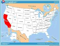
 National
Forests, Parks, and Monuments of California National
Forests, Parks, and Monuments of California
The following is a description of national
forests, parks, and monuments in the state
of California. If you plan to visit or live
in California for awhile then you should
definitely plan to visit some of these
fantastic places. |
|
|
|
National Forests |
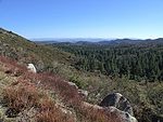
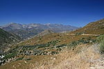
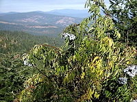
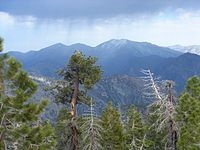
 Angeles Angeles
Located in the San Gabriel Mountains at the
edge of the Los Angeles metro area, this
National Forest includes five wilderness
areas. While much of the forest is dense
chaparral, elevations in the forest range
from 1,200 feet (370 m) to 10,064 feet
(3,068 m) at the summit of Mount San
Antonio. |
 Cleveland Cleveland
In southern California, Cleveland National
Forest has a Mediterranean climate and four
wilderness areas. There are 22 endangered
plant and animal species found in the
forest. With its highest point at 6,271 ft
(1,911 m) on Monument Peak, elevations are
not as high here as in most of California's
other National Forests. |
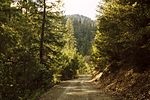
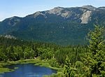
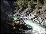
 Eldorado Eldorado
In the Sierra Nevada, Eldorado National
Forest has 611 mi (983 km) of fishable
streams and 297 lakes and reservoirs. There
are 349 mi (562 km) of trails and 2,367 mi
(3,809 km) of roads in the forest. The
forest's Desolation Wilderness is the most
visited wilderness area per acre in the
country. |
 Humboldt-Toiyabe Humboldt-Toiyabe
As the largest National Forest outside of
Alaska, Humboldt-Toiyabe occupies many of
the mountains of Nevada's Basin and Range
Province. Spring Mountains National
Recreation Area is located near Las Vegas
and is part of the forest. This national
forest is also partially located in the
state of Nevada. |
 Inyo Inyo
Located in the Sierra Nevada, Inyo includes
Mono Lake, bristlecone pines, the Long
Valley Caldera, nine wilderness areas, and
Mount Whitney, which at 14,505 ft (4,421 m)
is the highest point in the United States
outside of Alaska. This national forest is
also partially located in the state of
Nevada. |
 Klamath Klamath
Straddling the California-Oregon border,
this forest has part of five wilderness
areas, 152 mi (245 km) of wild and scenic
rivers, and 200 mi (320 km) of rivers for
rafting, including on the Klamath River.The
Siskiyou mariposa lily is endemic to the
forest, being found nowhere else in the
world. This national forest is also
partially located in the state of Oregon. |
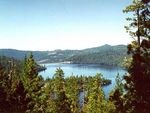
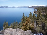 Lake
Tahoe Basin Management Unit Lake
Tahoe Basin Management Unit
The Forest Service lands surrounding Lake
Tahoe are managed by the Lake Tahoe Basin
Management Unit, which was created in April
1973 in order to protect the lake's unique
ecological and recreational values. This
management unit is also partially located in
the state of Nevada. |
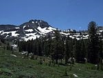
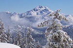
 Lassen Lassen
Surrounding Lassen Volcanic National Park,
this forest has three wilderness areas and
92,000 acres (37,000 ha) of old-growth
Sierra Nevada mixed conifer forests. Subway
Cave is a lava tube that is 0.3 mi (0.48 km)
long and open to the public. |
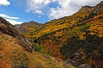
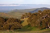
 Los
Padres Los
Padres
Encompassing portions of the California
Coast and Transverse ranges of central
California, Los Padres has ten wilderness
areas covering about 48% of the forest.
There are 1,257 mi (2,023 km) of trails and
part of the Jacinto Reyes National Scenic
Byway. |
 Mendocino Mendocino
Mendocino is the only National Forest in
California not crossed by a paved highway.
The forest's Genetic Resource and
Conservation Center produces plants for
reforestation, watershed restoration,
wildlife recovery, and other projects. |
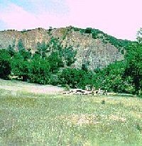
 Modoc Modoc
Modoc National Forest contains the Medicine
Lake Volcano, which has an elevation of
7,921 ft (2,414 m) and is the largest shield
volcano in North America. There are 43,400
acres (17,600 ha) of old-growth forest here
along with Mill Creek Falls in the South
Warner Wilderness. |
 Plumas Plumas
There are 127,000 acres (51,000 ha) of
old-growth forest in Plumas National
Forest.[99] The Little Grass Valley
Recreation Area surrounds Little Grass
Valley Reservoir and includes a campground
and boat launch, among other facilities and
services. |
 Rogue
River-Siskiyou Rogue
River-Siskiyou
This forest ranges from the Cascade Range to
the Siskiyou Mountains, and the Rogue River
drains over 75% of the forest's area. There
are parts of eight wilderness areas in the
forest as well as what may be the world's
tallest pine tree, a ponderosa pine that is
268.35 ft (81.79 m) tall. This national
forest is also partially located in the
state of Oregon. |
 San
Bernardino San
Bernardino
San Bernardino National Forest includes part
of the Santa Rosa and San Jacinto Mountains
National Monument. The forest surrounds Lake
Arrowhead and other reservoirs. |
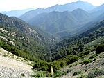
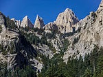
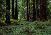
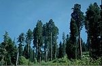 Sequoia Sequoia
Sequoia National Forest includes Giant
Sequoia National Monument, both named for
the giant sequoia, the largest tree species
in the world. There are 2,500 mi (4,000 km)
of maintained and abandoned roads and 850 mi
(1,370 km) of trails in the forest,
including the Pacific Crest Trail. |
 Shasta-Trinity Shasta-Trinity
There are 6,278 mi (10,103 km) of streams in
the forest, and elevations range from 1,000
ft (300 m) to 14,179 ft (4,322 m) on Mount
Shasta. Five wilderness areas and 460 mi
(740 km) of trails can be found in the
forest. |
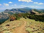
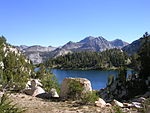 Sierra Sierra
Sierra National Forest is located on the
western slope of the Sierra Nevada and
elevations reach 13,986 ft (4,263 m). There
are 1,800 mi (2,900 km) of streams, 480
lakes, 11 reservoirs, and 63 campgrounds in
the forest. |
 Six
Rivers Six
Rivers
Six Rivers National Forest was named for the
Smith, Klamath, Trinity, Mad, Van Duzen, and
Eel rivers. The forest includes the Salmon
River system, all of which has been
designated a National Wild and Scenic River. |
 Stanislaus Stanislaus
Stanislaus National Forest has over 800 mi
(1,300 km) of streams and four wilderness
areas, including the Carson-Iceberg
Wilderness. The Emigrant Wilderness borders
the northwest corner of Yosemite National
Park. |
 Tahoe Tahoe
Tahoe National Forest is in the Sierra
Nevada northwest of Lake Tahoe. Part of the
Granite Chief Wilderness is within the
forest. The Middle Fork of the American,
Yuba, and North Yuba rivers cross or border
the forest. |
|
|
|
National Parks |
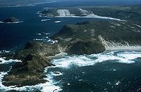 Channel
Islands Channel
Islands
Five of the eight Channel Islands are
protected, and half of the park's area is
underwater. The islands have a unique
Mediterranean ecosystem originally settled
by the Chumash people. They are home to over
2,000 species of land plants and animals,
and 145 are unique to them, including the
island fox. Ferry services offer
transportation to the islands from the
mainland. |
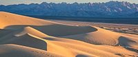
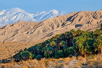
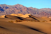 Death
Valley Death
Valley
Death Valley is the hottest, lowest, and
driest place in the United States, with
daytime temperatures that have exceeded 130
°F (54 °C). The park protects Badwater Basin
and its vast salt flats located at the
lowest elevation in North America, −282 ft
(−86 m).[34] The park also protects canyons,
badlands, sand dunes, mountain ranges,
historic mines, springs, and more than 1000
species of plants which grow in this
geologic graben. |
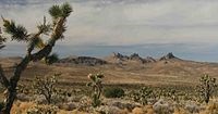
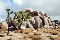 Joshua
Tree Joshua
Tree
Covering large areas of the Colorado and
Mojave Deserts and the Little San Bernardino
Mountains, this desert landscape is
populated by vast stands of Joshua trees.
Large changes in elevation reveal various
contrasting environments including bleached
sand dunes, dry lakes, rugged mountains, and
maze-like clusters of monzogranite
monoliths. |
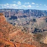
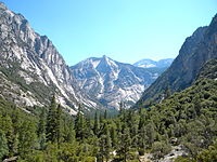 Kings
Canyon Kings
Canyon
Home to several giant sequoia groves and the
General Grant Tree, the world's second
largest measured tree, this park also
features part of the Kings River, sculptor
of the dramatic granite canyon that is its
namesake, and the San Joaquin River, as well
as Boyden Cave.[73] Although Kings Canyon
National Park was designated as such in
1940, it subsumed General Grant National
Park, which had been established on October
1, 1890 as the United States' fourth
national park. |
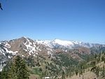
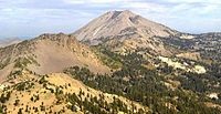 Lassen
Volcanic Lassen
Volcanic
Lassen Peak, the largest lava dome volcano
in the world, is joined by all three other
types of volcanoes in this park: shield,
cinder cone, and composite. Though Lassen
itself last erupted in 1915, most of the
rest of the park is continuously active.
Numerous hydrothermal features, including
fumaroles, boiling pools, and bubbling mud
pots, are heated by molten rock from beneath
the peak. |
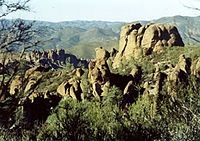 Pinnacles Pinnacles
Named for the eroded leftovers of a portion
of an extinct volcano, the park's massive
black and gold monoliths of andesite and
rhyolite are a popular destination for rock
climbers. Hikers have access to trails
crossing the Coast Range wilderness. The
park is home to the endangered California
condor (Gymnogyps californianus) and one of
the few locations in the world where these
extremely rare birds can be seen in the
wild. Pinnacles also supports a dense
population of prairie falcons, and more than
13 species of bat which populate its talus
caves. |
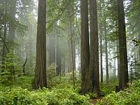 Redwood Redwood
This park and the co-managed state parks
protect almost half of all remaining coastal
redwoods, the tallest trees on earth. There
are three large river systems in this very
seismically active area, and 37 miles (60
km) of protected coastline reveal tide pools
and seastacks. The prairie, estuary, coast,
river, and forest ecosystems contain a wide
variety of animal and plant species. |
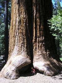
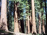 Sequoia Sequoia
This park protects the Giant Forest, which
boasts some of the world's largest trees,
the General Sherman being the largest
measured tree in the park. Other features
include over 240 caves, a long segment of
the Sierra Nevada including the tallest
mountain in the contiguous United States,
and Moro Rock, a large granite dome. |
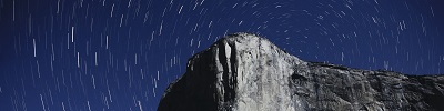
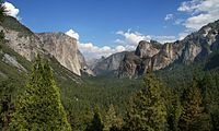 Yosemite Yosemite
Yosemite features sheer granite cliffs,
exceptionally tall waterfalls, and
old-growth forests at a unique intersection
of geology and hydrology. Half Dome and El
Capitan rise from the park's centerpiece,
the glacier-carved Yosemite Valley, and from
its vertical walls drop Yosemite Falls, one
of North America's tallest waterfalls at
2,425 feet (739 m) high. Three giant sequoia
groves, along with a pristine wilderness in
the heart of the Sierra Nevada, are home to
a wide variety of rare plant and animal
species. |
|
|
|
National Monuments |
 Berryessa
Snow Mountain Berryessa
Snow Mountain
Fewer than 100 miles (160 km) from the San
Francisco Bay Area, Berryessa Snow Mountain
protects part of the California Coast Range,
one of the most biodiverse regions in the
state, home to elk, osprey, river otters,
half the state’s dragonfly species, and
California’s second-largest population of
wintering bald eagles. |
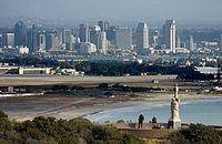 Cabrillo Cabrillo
This monument commemorates the landing of
Juan Rodríguez Cabrillo at San Diego Bay on
September 28, 1542, which was the first
European expedition on what later became the
west coast of the U.S. The monument includes
a statue of Cabrillo and 20th-century
coastal artillery batteries built to protect
the harbor of San Diego from enemy warships. |
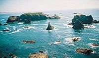 California
Coastal California
Coastal
This monument ensures the protection of all
islets, reefs and rock outcroppings from the
coast of California to a distance of 12
nautical miles (22 km), along the entire
840-mile (1,350 km) long California
coastline. |
 Carrizo
Plain Carrizo
Plain
Carrizo Plain is the largest single native
grassland remaining in California. It
contains part of the San Andreas Fault and
is surrounded by the Temblor Range and the
Caliente Range. At the center of the plain
is Soda Lake, which is near Painted Rock. |
 Cascade–Siskiyou Cascade–Siskiyou
One of the most diverse ecosystems found in
the Cascade Range, it has more than 100
dwelling and root-gathering sites belonging
to the Modoc, Klamath, and Shasta tribes.
This national monument is also partially
located in the state of California. |
 Castle
Mountains Castle
Mountains
Castle Mountains represents some of the most
unique elements of the Mojave Desert.
Nestled between the Nevada state line and
Mojave National Preserve, the nearly 21,000
acres of Castle Mountains boasts Joshua tree
forests, unbroken natural landscapes, rare
desert grasslands, and rich human history. |
 César
E. Chávez César
E. Chávez
This monument commemorates the life and work
of labor leader and civil right activist
Cesar Chavez. Called La Paz, the site was
Chavez's home for about 20 years, and his
gravesite is on the premises. It is also the
location of the headquarters of United Farm
Workers, which was founded by Chavez. |
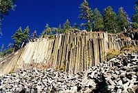 Devils
Postpile Devils
Postpile
Once part of Yosemite National Park, this
monument is a dark cliff of columnar basalt
created by a lava flow at least 100,000
years ago. It also has the 101-foot (31
m)-high Rainbow Falls. |
 Fort
Ord Fort
Ord
Fort Ord was an Army post from 1917 to 1994.
It now has recreational trails and various
wildlife. |
 Giant
Sequoia Giant
Sequoia
The monument includes 38 of the 39 giant
sequoia groves in the Sequoia National
Forest, amounting to about half of the
sequoia groves currently in existence. This
includes one of the ten largest giant
sequoias, the Boole Tree. Its two parts are
around Kings Canyon and Sequoia National
Parks. |
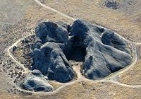
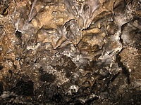 Lava
Beds Lava
Beds
This is the site of the largest
concentration of lava tube caves in North
America. It also includes Petroglyph Point,
one of the largest panels of Native American
rock art. The monument lies on the northeast
flank of the Medicine Lake Volcano, the
largest volcano in the Cascade Range. |
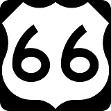
 Mojave
Trails Mojave
Trails
Spanning 1.6 million acres, more than
350,000 acres of previously
congressionally-designated Wilderness, the
Mojave Trails National Monument comprises a
stunning mosaic of rugged mountain ranges,
ancient lava flows, and spectacular sand
dunes. The monument will protect
irreplaceable historic resources including
ancient Native American trading routes,
World War II-era training camps, and the
longest remaining undeveloped stretch of
Route 66. |
 Muir
Woods Muir
Woods
Part of the Golden Gate National Recreation
Area, it protects one of the last old growth
Coast redwood (Sequoia sempervirens) groves
in the San Francisco Bay Area as well as one
of the most easily accessed. |
 Sand
to Snow Sand
to Snow
The 154,000-acre monument extends from
Bureau of Land Management lands on the
Sonoran desert floor up to over 10,000 feet
in the San Gorgonio Wilderness on the San
Bernardino National Forest. |
 San
Gabriel Mountains San
Gabriel Mountains
Covering 346,177 acres of the San Gabriel
mountains in northern Los Angeles County and
western San Bernardino County, California,
with peaks as high as 10,068 ft (3,069 m),
the San Gabriel Mountains provide one of the
few open-space recreation opportunities
close to residents of Los Angeles County and
is also an important watershed for the Los
Angeles area. |
 Santa
Rosa and San Jacinto Mountains Santa
Rosa and San Jacinto Mountains
This monument preserves large portions of
the Santa Rosa and San Jacinto ranges, the
northernmost of the Peninsular Ranges. Parts
are within San Bernardino National Forest
and the California Desert Conservation Area. |
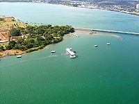 World
War II Valor in the Pacific World
War II Valor in the Pacific
Valor in the Pacific encompasses nine sites
in three states associated with World War
II: The Attack on Pearl Harbor, including
the USS Arizona, Utah, and Oklahoma
memorials in Hawaii; the Aleutian Islands
Campaign on Attu Island, Kiska Island, and
Atka Island in Alaska; and the Japanese
American internment at Tule Lake War
Relocation Center in California. This
national monument is also partially located
in the state of Alaska and Hawaii. |

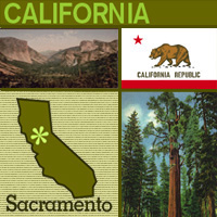

 California
State Facts
California
State Facts