|
|
| |
|
|
| |
|
|
|
|
| |
 Travel
America Travel
America
Learn before you travel. This section of Fun Easy
English focuses on facts and other cool stuff about
your favorite U.S. state. This is great English
reading practice. This page focuses on the state of
Arizona. |
 Hey
if you cannot understand something on this page, Hey
if you cannot understand something on this page,
then use the Fun Easy English
dictionary
(opens in a new window) |
|
|
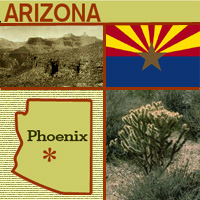 Arizona Arizona
The "Grand Canyon State," Arizona, was the 48th
state to join the U.S. in 1912-- the last of 48
contiguous (connected) states to join the Union. The
state's name comes from arizonac, from two Papago
Indian words meaning "place of the young spring."
Arizona has a very dry climate and is known for its
cactus plants. In fact, the state flower is the
saguaro cactus blossom. |
|
Arizona
State Flag
The state flag of Arizona "represents the copper
star of Arizona rising from a blue field in the face of a
setting sun" (quote from legislation).
In 1911 a rifle team from the Arizona Territory was
scheduled for a competition match in Ohio and needed a flag
to represent their team. Charles Harris (the Adjutant
General of the territory) quickly designed what was to
become the Arizona state flag (Arizona was admitted to the
Union in 1912 - this flag became the official flag of
Arizona in 1917).
The 13 gold and red "beams" or "rays" on Arizona's flag
represent the sun setting over the western desert and the
original 13 colonies (red and gold colors were also carried
by Coronado's Spanish expedition in search of the Seven
Cities of Cibola in 1540).
The center star signifies copper production (Arizona
produces more copper than any other state in the country).
The field of blue is the same "liberty blue" as the United
States flag. Blue and "old gold" are also Arizona's official
state colors. |
|
Source:
State Symbols USA |
|
|
 Arizona
State Facts Arizona
State Facts
Picture: state seal of Arizona |
|
State Capital |
Phoenix |
|
Nickname |
Grand Canyon State |
|
Motto |
Ditat Deus (God enriches) |
|
Statehood |
February 14, 1912 (48th) |
|
Origin of Name |
Spanish interpretation of "arizuma," an Aztec Indian
word meaning "silver-bearing." Also based on Pima
Indian word "arizonac" for "little spring place." |
|
Largest Cities |
Phoenix, Tucson, Mesa, Glendale, Scottsdale |
|
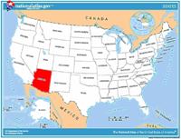
Border States |
California, Colorado, Nevada, New Mexico, Utah |
|
Area |
113,642 sq. mi., 6th largest |
|
State Bird |
Cactus Wren |
|
State Flower |
Saguaro cactus blossom (carnegiea gigantea) |
|
State Tree |
Palo verde (cercidium) |
|
State Song |
Arizona |
 Travel and tourism site for Arizona - This state travel and
territorial tourism site provides ideas for your vacations,
meetings, and more. Travel and tourism site for Arizona - This state travel and
territorial tourism site provides ideas for your vacations,
meetings, and more. |
|
|
Arizona Stories |
|
|
The Annual Waila Festival
Would you ever guess that 'waila' was a kind of social dance music?
Also known as "chicken scratch" music, waila music is featured at
the Annual Waila Festival in Tucson.
Waila music comes from the Tohono O'odham, the native people of the
Sonoran desert and the largest Indian nation of southern Arizona.
Waila (pronounced why-la) is an O'odham word that comes from the
Spanish word "baile," which means "to dance." There are no words to
waila music -- it is only instrumental, and is played on a button
accordion, alto saxophone, electric six-string and bass guitars, and
drums.
Waila began from the music of early fiddle bands that adapted
European and Mexican tunes heard in northern Sonora. The dances
performed in the waila tradition are the waila (which is similar to
a polka), the chote (based on a folk dance from Scotland or
Germany), and the mazurka (based on a Polish folk dance). Regardless
of the beat, all waila dances are performed while moving around the
floor in a counterclockwise direction. |
|
|
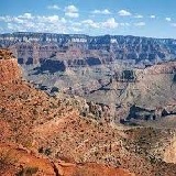
Arizona's Grand Canyon
The Grand Canyon is an immense steep valley in northwestern Arizona.
Do you know what led the first European to go there?
García López de Cárdenas, a Spanish explorer, was the first European
to see the Grand Canyon, in 1540. He stumbled across it in his
search for fabled cities thought to be filled with treasure and
riches -- the Seven Golden Cities of Cibola. His journey was
considered a failure because he never found the gold he sought.
Native Americans, called the Anasazi, lived along the Grand Canyon
long before Europeans ever set eyes on it. The Anasazi, who are
thought to be the ancestors of the present-day Hopi, lived in caves
and pit houses along the edges of the canyon in pueblos (towns). The
Hopi believe the Grand Canyon is a Sipapu, a place from which all
people emerged from another world into this one. |
|
|
Grand Canyon Mule Trail Rides
Would you like to take a trip into the Grand Canyon? Then, hold on
to your horses -- or better yet, your mule. That's right, mule.
Mules are well suited for traversing the Grand Canyon. They are
three times as strong as a horse, more sure-footed, intelligent, and
trainable. They are known for having a stubborn nature, but this is
due to their strong sense of self-preservation.
Riding into the canyon, "is not a pony ride at Disneyland,"
according to Ron Clayton, manager of the Grand Canyon Mule
Operation. He prepares people who want to take the trip for a tough,
yet satisfying, experience. Riders have a choice of two separate
trips leaving the South Rim of the Canyon: the first is a one-day
ride down Bright Angel Trail to Plateau Point, where the mule riders
can look out over the Colorado River. The second is an overnight
ride that ends at Phantom Ranch, where riders can spend one or two
nights exploring the bottom of the Canyon. Are you ready to saddle
up? |
|
|
Hashknife Pony Express
If you thought the pony express was a thing of the past, think
again. Did you know you can still have mail delivered by horses?
Arizona has the only pony express that still delivers mail for the
U.S. Postal Service. The Hashknife Pony Express makes its ride every
January during the Parada del Sol festival, traveling 200 miles from
Holbrook, Arizona, to Scottsdale, Arizona, and delivering 20,000
first-class letters by horseback. The ride is led by the Navajo
County Hashknife Sheriff's Posse, which was organized as a
search-and-rescue group in 1955. More than two dozen riders in
authentic cowboy clothing carry the mail, relaying the bags along
the route. As the word has spread about the ride, public
participation has increased, with many letters arriving in the
Holbrook Post Office the week before the ride, marked "via Pony
Express." Each letter is stamped with a special mark, or cachet. The
arrival of the Hashknife Pony Express in Scottsdale kicks off the
annual Parada del Sol. |
|
|
Arizona Book Festival
What do you need to have a book festival? Authors, readers, and, of
course, books! One component of books is paper, and in this photo
you can see kids at the Arizona Book Festival, learning how to make
paper.
The Arizona Book Festival started in 1998 when the Arizona
Humanities Council decided to feature the many good writers from the
South and West and to sponsor book-related events that take place in
libraries, bookstores, community centers, and other educational and
cultural spaces. The authors invited to the Arizona Book Festival
represent different cultures, literary styles, and subject matter.
Barbara Kingsolver is one of the authors from the Southwest who is
honored at the festival. Born in Kentucky, Kingsolver moved to
Arizona, and her first novel, The Bean Trees, is about a young woman
who leaves rural Kentucky and finds herself living in Tucson,
Arizona. Many of her other novels also take place in Kentucky and
Arizona.
Other events at the festival include characters from books, who make
special appearances, like Clifford the Big Red Dog. |
|
|
The Bill Williams Mountain Men of Williams,
Arizona
What would you do to keep a legend alive? Would you dress up in
old-fashioned clothing and follow old trails, sleeping under the
stars? That's exactly what the Bill Williams Mountain Men do as they
explore the mountains, canyons, and deserts of Arizona during their
annual spring 200-mile Rendezvous Ride.
The group is named after "Old Bill Williams," a legendary fur
trapper who was born in North Carolina and traveled to the mountains
of the West for adventure and to preach. It is believed Old Bill was
killed in Southern Colorado in 1849.
The Bill Williams Mountain Men wear buckskin outfits, hats and
moccasins. They sleep under the stars and re-enact the rides of the
early trappers who made their trips in the spring to sell their
furs. These "Mountain Men" are businessmen, doctors, judges, and
ranchers who do this to raise money for charities and scholarships
for students. They also visit schools and hospitals to bring the
story of Arizona's Western heritage to youth. They often take part
in parades or presidential inaugurations, all in the effort to keep
alive the memory and romance of an adventurous group of mountain
men, particularly Old Bill Williams. |
|
|
Gold Rush Days in Wickenburg, Arizona
How would you like to strike gold? There is a gold rush going on in
Wickenburg, Arizona. You just have to get in and muck about! Every
year, the Wickenburg Chamber of Commerce sponsors a festival to
celebrate the town's mining and ranching heritage, and participants
get to shovel and pan for gold!
Wherever gold is discovered, there is usually a large rush of people
who are hoping to get rich quick, which is why it is called a "gold
rush." When Henry Wickenburg, an adventurer, discovered gold along
the Hassayampa River in 1863, it caused a gold rush, and the town
was founded.
In 1948, the Wickenburg Chamber of Commerce decided to hold a
festival in honor of this discovery. Contests include a drilling and
mucking contest and a gold-panning contest. Drilling and mucking is
the way that gold is taken from the ground. A mucker is a machine
that gets the rock out of the ground and moves broken rock onto a
conveyor belt. A hand mucker is a man who shovels ore and unwanted
rock out of a mine. Gold panning is the way in which gold dust and
flecks are removed from streams and rivers. It takes a lot of work
to strike gold! |
|
Source:
Library of Congress |
|
 National
Forests, Parks, and Monuments of Arizona National
Forests, Parks, and Monuments of Arizona
The following is a description of national
forests, parks, and monuments in the state
of Arizona. If you plan to visit or live in
Arizona for awhile then you should
definitely plan to visit some of these
fantastic places. |
|
|
|
National Forests |
 Apache-Sitgreaves Apache-Sitgreaves
Encompassing the Mogollon Rim and White
Mountains, this forest includes 34 lakes and
over 680 miles (1,090 km) of rivers and
streams, more than any other National Forest
in the arid Southwest. This national forest
is also partially located in the state of
New Mexico. |
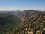 Coconino Coconino
The San Francisco Peaks, Mogollon Rim, and
Oak Creek Canyon can be found in Coconino
National Forest. The forest's Sycamore
Canyon is the second largest canyon in
Arizona's redrock country. The forest also
contains Humphreys Peak, which at 12,637 ft
(3,852 m) is the highest point in Arizona. |
 Coronado Coronado
Covering the sky islands of the Southwest,
Coronado National Forest also includes Mount
Wrightson and the birding destination of
Madera Canyon. There are eight wilderness
areas in the forest as well as observatories
on Mount Hopkins and Mount Lemmon. This
national forest is also partially located in
the state of New Mexico. |
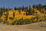 Kaibab Kaibab
Located on the Colorado Plateau to both the
north and south of Grand Canyon National
Park, elevations in Kaibab National Forest
reach 10,418 ft (3,175 m) on Kendrick
Mountain in the Kendrick Mountain
Wilderness. There are over 300 mi (480 km)
of trails in the forest, including through
the Kanab Creek Wilderness. |
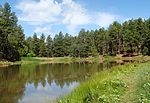 Prescott Prescott
Vegetation in Prescott National Forest
ranges from that characteristic of the
Sonoran Desert at lower elevations to
Ponderosa pine at higher elevations. There
are eight wilderness areas and 450 mi (720
km) of trails in the forest. |
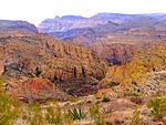 Tonto Tonto
Tonto National Forest stretches from the
Sonoran Desert to the pine forests at the
Mogollon Rim. There are eight wilderness
areas and several lakes and reservoirs in
the forest. |
|
|
|
National Parks |
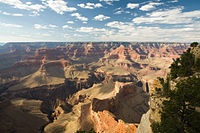 Grand
Canyon Grand
Canyon
The Grand Canyon, carved by the mighty
Colorado River, is 277 miles (446 km) long,
up to 1 mile (1.6 km) deep, and up to 15
miles (24 km) wide. Millions of years of
erosion have exposed the multicolored layers
of the Colorado Plateau in mesas and canyon
walls, visible from both the north and south
rims, or from a number of trails that
descend into the canyon itself. |
 Petrified
Forest Petrified
Forest
This portion of the Chinle Formation has a
large concentration of 225-million-year-old
petrified wood. The surrounding Painted
Desert features eroded cliffs of red-hued
volcanic rock called bentonite. Dinosaur
fossils and over 350 Native American sites
are also protected in this park. |
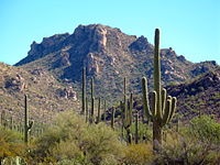 Saguaro Saguaro
Split into the separate Rincon Mountain and
Tucson Mountain districts, this park is
evidence that the dry Sonoran Desert is
still home to a great variety of life
spanning six biotic communities. Beyond the
namesake giant saguaro cacti, there are
barrel cacti, chollas, and prickly pears, as
well as lesser long-nosed bats, spotted
owls, and javelinas. |
|
|
|
National Monuments |
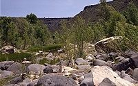 Agua
Fria Agua
Fria
Located around the canyon of the Agua Fria
River, it contains more than 450 distinct
Native American structures, including large
pueblos with more than 100 rooms. |
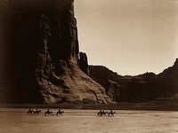 Canyon
de Chelly Canyon
de Chelly
Located within the boundaries of the Navajo
Nation, it preserves the valleys and rims of
the canyons of de Chelly, del Muerto, and
Monument, all of which are Navajo Tribal
Trust Lands. |
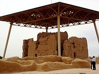 Casa
Grande Ruins Casa
Grande Ruins
This monument preserves a group of
structures surrounded by a compound wall in
the Gila Valley that were built in the early
13th century. They were inhabited by the
Hohokam people until they were abandoned in
the mid-15th century. |
 Chiricahua Chiricahua
These pillars of rhyolite tuff are the
eroded remains of an immense volcanic
eruption that shook the region some 27
million years ago. It was called the Land of
the Standing-Up Rocks by the Apache. |
 Grand
Canyon-Parashant Grand
Canyon-Parashant
Located on the northern rim of the Grand
Canyon, this diverse landscape includes an
array of scientific and historic resources.
About 20,000 of the monument's 1,017,000
acres (4,120 km2) are also within Lake Mead
National Recreation Area; Grand Canyon-Parashant
is not considered an official NPS unit.
There are no paved roads or visitor
services. |
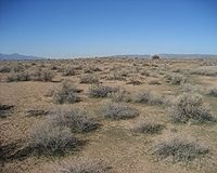 Hohokam
Pima Hohokam
Pima
Hohokam Pima is part of the Gila River
Indian Community and not open to the public.
The monument preserves the Snaketown-Settlement,
archeological remains of the Hohokam
culture, which lived in the area until 1500. |
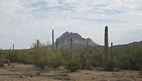 Ironwood
Forest Ironwood
Forest
Located within the Sonoran Desert,
significant concentrations of ironwood (Olneya
tesota) trees and two endangered animal and
plant species are found within the monument.
More than 200 Hohokam and Paleoindian
archeological sites have been identified
from between 600 and 1450 AD. |
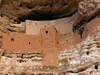 Montezuma
Castle Montezuma
Castle
Montezuma Castle features cliff dwellings
built by the Pre-Columbian Sinagua people
between 1100 and 1400 AD. The site's name is
a misnomer as is it has no connection to
Montezuma. However, some modern day native
tribes that do have connections to the site
include the Yavapai, Hopi, and Zuni. The
monument also includes Montezuma Well, which
has been used for irrigation since the 8th
century. |
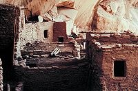 Navajo Navajo
This monument preserves three of the most
intact cliff dwellings of the Ancestral
Puebloan people. The monument is high on the
Shonto plateau, overlooking the Tsegi Canyon
system on the Navajo Nation in Northern
Arizona. |
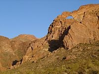 Organ
Pipe Cactus Organ
Pipe Cactus
This monument is the only place in the
United States where the organ pipe cactus
grows wild. There are many other types of
cacti and desert flora native to the Sonoran
Desert. The Bates Well Ranch and Dos Lomitas
Ranch are also within the monument. |
 Pipe
Spring Pipe
Spring
Rich with Native Americans, early explorer
and Mormon pioneer history, this site shows
Ancestral Puebloans and Kaibab Paiute Indian
and pioneer life in the Old West, including
the cabin where explorer John Wesley
Powell's survey crew stayed in 1871. The
water of Pipe Spring, discovered in 1858,
made it possible for plants, animals, and
people to live in this dry desert region. |
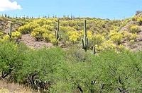 Sonoran
Desert Sonoran
Desert
This monument protects a small portion of
the Sonoran Desert. It is home to several
federally listed endangered species and also
has three wilderness areas, many significant
archeological and historic sites, and
remnants of several important historic
trails. |
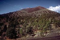 Sunset
Crater Volcano Sunset
Crater Volcano
Sunset Crater is the youngest in a string of
volcanoes in the San Francisco volcanic
field that is related to the nearby San
Francisco Peaks. Final volcanic activity in
the 13th century painted the upper portion
of the cone with bright red and orange
rocks, giving the volcano its name. |
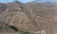 Tonto Tonto
Lying on the northeastern edge of the
Sonoran Desert along the Salt River, Tonto
preserves two cliff dwellings that were
occupied by the Salado culture during the
13th to 15th centuries. The monument is
surrounded by Tonto National Forest. |
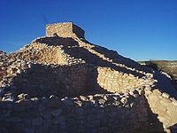 Tuzigoot Tuzigoot
Tuzigoot preserves a two- to three-story
pueblo ruin on the summit of a limestone and
sandstone ridge in the Verde Valley. It was
built by the Sinagua people between 1125 and
1400. |
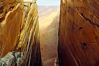 Vermilion
Cliffs Vermilion
Cliffs
Steep eroded escarpments consisting
primarily of sandstone, siltstone, limestone
and shale rise as much as 3,000 feet (910 m)
above their base. These sedimentary rocks
have been deeply eroded for millions of
years, exposing hundreds of layers of richly
colored rock strata. The monument protects
Paria Plateau, Vermilion Cliffs, Coyote
Buttes and Paria Canyon. |
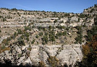 Walnut
Canyon Walnut
Canyon
Walnut Canyon protects 25 cliff dwelling
rooms constructed by the Sinagua people. It
lies on the Colorado Plateau and cuts
through the Permian Kaibab Limestone, which
exposes the Toroweap Formation and Coconino
Sandstone. |
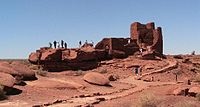 Wupatki Wupatki
Many settlement sites built by the Sinagua,
Cohonina, and Ancestral Puebloans are
scattered throughout the monument. About
2000 Ancient Pueblo People moved here to
farm after an 11th century eruption of
Sunset Crater. |
|
|
|
|
Travel America |
|
|
Saguaro National Park
(Beginner - Listening,
reading)
A video lesson which shows you an interesting place in America.
The English is
spoken at 75% of normal speed.
Great English listening and reading practice.
This video is all about Saguaro National Park. |
|
|
|
|
|
|
|
|
Cool America |
 About the U.S.A. About the U.S.A.
About the U.S.A. is an American
Studies reader that examines the customs, government, and history of the
United States of America. The text provides a wealth of information on U.S.
geography and history; the roles of local, state, and federal government;
national holidays and symbols; the Constitution; and citizenship. The book,
which was written for intermediate to advanced learners of English, contains
a range of activities for language students to practice listening, speaking,
reading, and writing. (opens to a new PDF window)
Great English reading
practice. |
 About
America About
America
Learn about the fascinating history and government of
the United States of America. Lessons include content on
American Government, American History, and Integrated
Civics. Handouts with interactive games and
student-centered activities encompass all four language
skills: speaking, listening, reading, and writing.
Great English reading practice for
beginning to intermediate students. |
 American Teens Talk! American Teens Talk!
Americans Teens Talk! is a collection of interviews of
American high school students. Each interview is accompanied by vocabulary
notes and discussion questions. The interviews in American Teens Talk! give
learners a view into the lives of adolescents in the U.S. Through the
written format of the interviews, learners are able to increase their
vocabulary, practice their reading and listening skills, engage in
discussions, and learn more about U.S. culture. These
interviews come with audio programs.
Great English listening and
reading |
 Sing Out Loud Children's Songs Sing Out Loud Children's Songs
Sing Out Loud Children's Songs includes popular children's songs in the U.S.A. Posters accompany the
individual Sing Out Loud Children's Songs. These
songs come with audio programs.
Great English listening and reading
practice. |
 Sing Out Loud Traditional Songs Sing Out Loud Traditional Songs
The Sing Out Loud Traditional Songs
collection contains 13 traditional American folk songs and song lyrics.
Listen to the songs online, read the lyrics, and collect the posters that
accompany the songs. These
songs come with audio programs.
Great English listening and reading
practice. |
 Sing Out Loud American Rhythms Sing Out Loud American Rhythms
Do you love music? Want to use it
to learn English? Check out the hip-hop inspired song "Peace" from Sing Out
Loud American Rhythms. American Rhythms includes a variety of musical genres
from many different artists in the U.S.A. These songs will appeal to teens
and young adults. These
songs come with audio programs.
Great English listening and reading
practice. |
 Route
66 - Famous American Road Route
66 - Famous American Road
U.S. Route 66 (US 66 or Route 66), also known as the Will Rogers Highway, the
Main Street of America or the Mother Road, was one of the original highways in
the U.S. Highway System. The highway, which became one of the most famous roads
in the United States, originally ran from Chicago, Illinois, through Missouri,
Kansas, Oklahoma, Texas, New Mexico, and Arizona before ending in Santa Monica,
California, near Los Angeles, covering a total of 2,448 miles (3,940 km). It was
recognized in popular culture by both the hit song "(Get Your Kicks on) Route
66" and the Route 66 television show in the 1960s. |
Route 66: The Highway That's the Best
(Beginner - Listening)
A video lesson which shows you an interesting place in America.
The English is
spoken at 75% of normal speed.
Great English listening practice.
This video shows travel along Route 66, the most famous road in
America. |
Chicago: The Start of Route 66
(Beginner - Listening)
A video lesson which shows you an interesting place in America.
The English is
spoken at 75% of normal speed.
Great English listening practice.
This video shows travel along Route 66, the most famous road in
America. |
Going West for Decades on Route 66
(Beginner - Listening)
A video lesson which shows you an interesting place in America.
The English is
spoken at 75% of normal speed.
Great English listening practice.
This video shows travel along Route 66, the most famous road in
America. |
Arizona: The Spirit of Route 66
(Beginner - Listening)
A video lesson which shows you an interesting place in America.
The English is
spoken at 75% of normal speed.
Great English listening practice.
This video shows travel along Route 66, the most famous road in
America. |
Route 66 California: The End of the Trail
(Beginner - Listening)
A video lesson which shows you an interesting place in America.
The English is
spoken at 75% of normal speed.
Great English listening practice.
This video shows travel along Route 66, the most famous road in
America. |
Ten Must-See Route 66 Attractions
(Beginner - Listening)
A video lesson which shows you an interesting place in America.
The English is
spoken at 75% of normal speed.
Great English listening practice.
This video shows travel along Route 66, the most famous road in
America. |
Four Famous Foods On Route 66
(Beginner - Listening)
A video lesson which shows you an interesting place in America.
The English is
spoken at 75% of normal speed.
Great English listening practice.
This video shows travel along Route 66, the most famous road in
America. |
International Tourists Drawn to Route 66
(Beginner - Listening)
A video lesson which shows you an interesting place in America.
The English is
spoken at 75% of normal speed.
Great English listening practice.
This video shows travel along Route 66, the most famous road in
America. |
|
|
|
|
Search Fun Easy English |
|
|
|
|
|
|
|
|
|
|
|
|
|
|
|
About
Contact
Copyright
Resources
Site Map |